
This post (likely) contains affiliate links, including Amazon Associates links, and I may receive a small commission if you click one. This is at no extra cost to you.
As someone who is fascinated by old buildings, history and days gone by, I set about finding Church ruins in Norfolk I could visit. When I started doing my research, I couldn’t find a list anywhere that had a whole heap on it. So armed with Google Maps, a car, and some random wrong turns, I discovered all of the following church ruins in Norfolk. It is amazing, actually, how many there are! According to research, there are over 100 church ruins in Norfolk, and each has its own fascinating and interesting history.
So, if you are ever in Norfolk and want to do something a bit different, use this guide to help uncover some old and impressive church ruins! This ruins in Norfolk post is split into areas to try and make navigating a little easier!
And if you come across or know of any other ruins in Norfolk – please do let me know!
King’s Lynn and West Norfolk Area – church ruins in Norfolk
Wiggenhall Saint Peter
Located in the tiny village of Wiggenhall, in West Norfolk, not too far from the town of King’s Lynn. This church was last known to be in use in the 1930s before its decline. It is a very impressive building, with the main structure still intact, just the roof missing. Today, it is looked after by the Norfolk Historic Churches Trust, which maintains the structure. It is thought to date from the 15th Century and to have been left to ruin when the canal building blocked the through road to the village.

112 St Peters Rd, Wiggenhall St Peter, King’s Lynn PE34 3HF | Map
Church of St James, Bawsey
A 20-minute drive from Wiggenhall St Peter is the ruins in Norfolk of an old church in Bawsey. To find these ruins, you have to drive down a farm track. Your car will only take you so far, so park up and walk the rest. As you drive towards them, you will see the outline of the old church on the hill before you.

Although the church stands completely isolated today, it used to be the centre of a thriving village. There are no other signs of the village left, but fragments of pottery and other finds show there was a settlement here during the Iron Age. The church began to fall into decline after the village was destroyed in the 16th Century. The landowner decided to clear the tenants and destroy their homes to create new grazing pastures for sheep. The church was not demolished, but its condition gradually deteriorated. It was reported in 1679 that the tower needed repairing. But despite this, baptisms and burials continued in St James until the 1770s.
Now, this ruin is left to stand on a windy hilltop. Looking a little gloomy and eerie, harking back to a village that is long gone.
Bawsey Ruins, Kings Lynn, PE32 1EU | Map
Appleton St Mary
This ruin is located very near the royal estate of Sandringham, so if you are visiting there, make sure to swing by this church on your way home!
Appleton is another village that no longer exists! When it snows, you can see the outline of streets and buildings where they once stood in the neighbouring fields behind the ruined church. The tower arch seems to date from Norman times. However, there is evidence that the tower itself could even date from pre-Conquest! Until recently, it was quite overgrown, but it has since been cleared. There is a fence around the outside, but definitely an interesting church to visit!
Appleton St Mary | Appleton Drove, Appleton, King’s Lynn PE31 6BB | Map
St Andrew’s, Bircham Tofts
This ruin I found really sad! It is a medieval church with parts of a 13th-century nave, with 15th- and then 19th-century additions. It seems to have been unroofed in 1952, but it is unclear as to why. Ivy has grown up over the entire church, so it is hard to spot!

Church Ln, Bircham Tofts, King’s Lynn PE31 6QW | Map
Castle Acre Priory
Castle Acre is one of the largest and best-preserved monastic ruins in England, dating back to 1090. Founded by the Warenne family not long after the Norman Conquest. For almost 450 years, Castle Acre Priory was the home and workplace of monks and their servants, a refuge for pilgrims, and a stopping point for royalty, clergy and nobility. It was also part of a vast monastic network centred on the great abbey of Cluny in France. Today the impressive ruins are a really special place to walk around.
English Heritage runs it, and the entry is £8.70 for an adult.

When visiting the Priory, make sure to take a walk through the really picturesque village of Castle Acre. From there, you can walk to the site and ruins of Castle Acre itself, which is free to enter.
Priory Rd, Castle Acre, King’s Lynn PE32 2XD | Map
Breckland Area – church ruins in Norfolk
All Saints, Garboldisham
All Saints was one of two churches in the village of Garboldisham. In the 18th Century, the tower (dating from the 14th century) collapsed into the nave. There was a lot of pressure during this time on churches and their capacity. As such, the church was abandoned. Only half of the tower now remains, a little sad, near the beautiful remaining church of the village.

Garboldisham, Diss | Map
St Andrew, Roudham
This is such an interesting set of ruins in Norfolk! There is a lot left to explore, so it looks very impressive in the little village of Roudham. The church was destroyed by fire in 1736. The story goes that workmen were repairing the church and accidentally set fire to the roof.
This church is unusual in that its entrance was through the tower. There is also evidence of some church buildings being there since the Saxon times. Indeed, there is a Saxon burial slab on display in the information hut right next to the church. The graveyard is still in use to this day.

Roudham, Norwich NR16 2RJ | Map
St. Edmund’s Chapel, Lyng
Some ruins in Norfolk are more impressive than others. And there isn’t a huge amount left of this one. Set in the middle of a farmer’s field, two mounds are still visible. Both are fairly covered in ivy. It does have an interesting history, however. This was a chapel that was part of a Benedictine Nunnery. It is unknown when it was built, but the nunnery was moved to Thetford in 1197. However, the chapel was still in use until 1250. By 1730, it was in ruins.

Lyng, Norfolk | Map
North Elmham Chapel, North Elmham
This chapel is managed by English Heritage and has a varied history! In the late Saxon period, this was the principal seat of the Bishops of East Anglia.
Excavations have shown evidence that there was an earlier timber structure, probably the Anglo-Saxon cathedral, which went out of use when the seat of the Bishop was transferred to Thetford in 1071.
Bishop Herbert de Losinga then founded a new parish church for the village somewhere between 1091 and 1119. He built a small private chapel for his own use on the site of the old timber church.

In the 14th century, the chapel was turned into a house, and in 1388 a royal licence was obtained to fortify it. There is no record of any bishop occupying the site after the death of the last in 1406. When Elmham passed into the hands of Thomas Cromwell, the ‘castle’ site was given to the vicarage and gradually fell into ruin.
It is interesting to wander around, and there are a lot of information boards to give you a more detailed history of the site. Recommend!
Church Ln, North Elmham, Dereham NR20 5JU | Map
St Andrew, Rockland All Saints
There used to be three churches in the small area of Rockland All Saints and Rockland St Peter, so it is easy to see why this church fell into disuse. The village of All Saints had two churches, St Andrew and All Saints, which remain today. After the Reformation, there would have been very little need for two churches so close together in such a remote place.
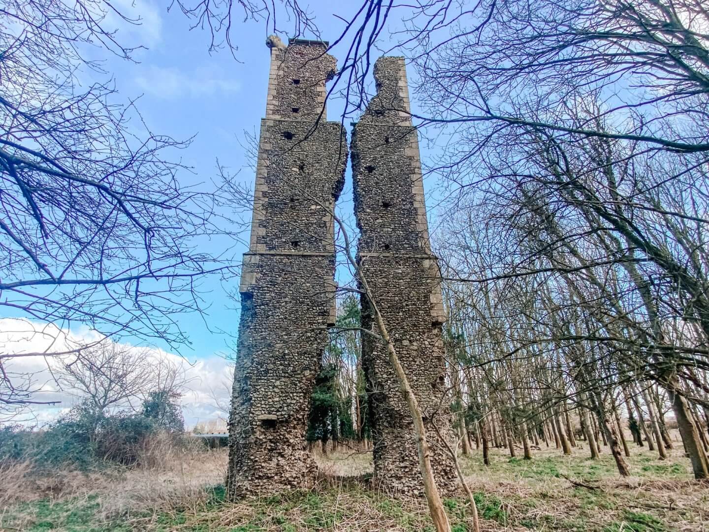
What survives of St Andrew is the west wall, which is split down the middle. The tower seems to have been rectangular rather than square. Remote and quite hard to get to, but an interesting place to see nonetheless.
Attleborough NR17 1XN | Map
All Saints, Oxwick
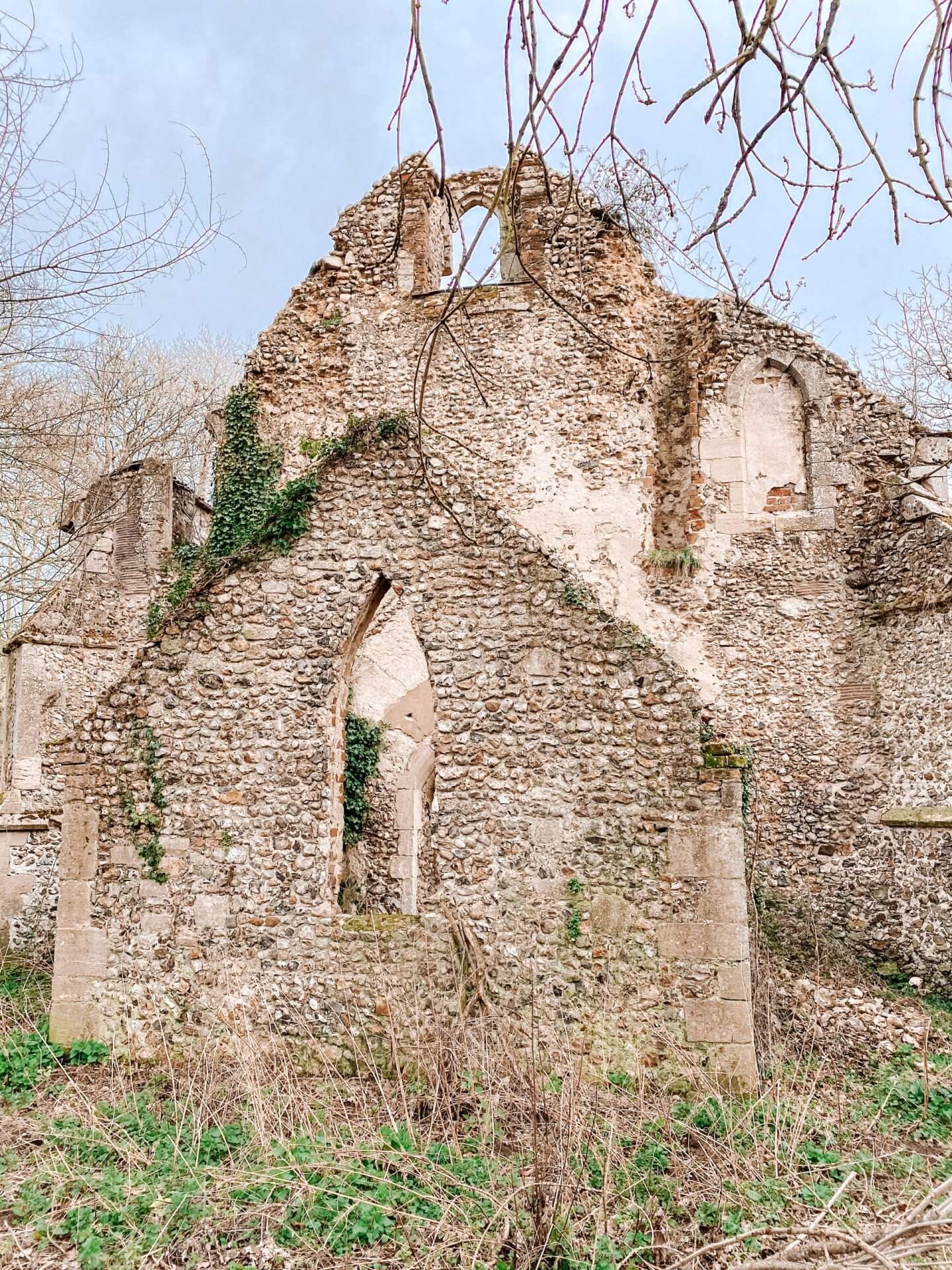
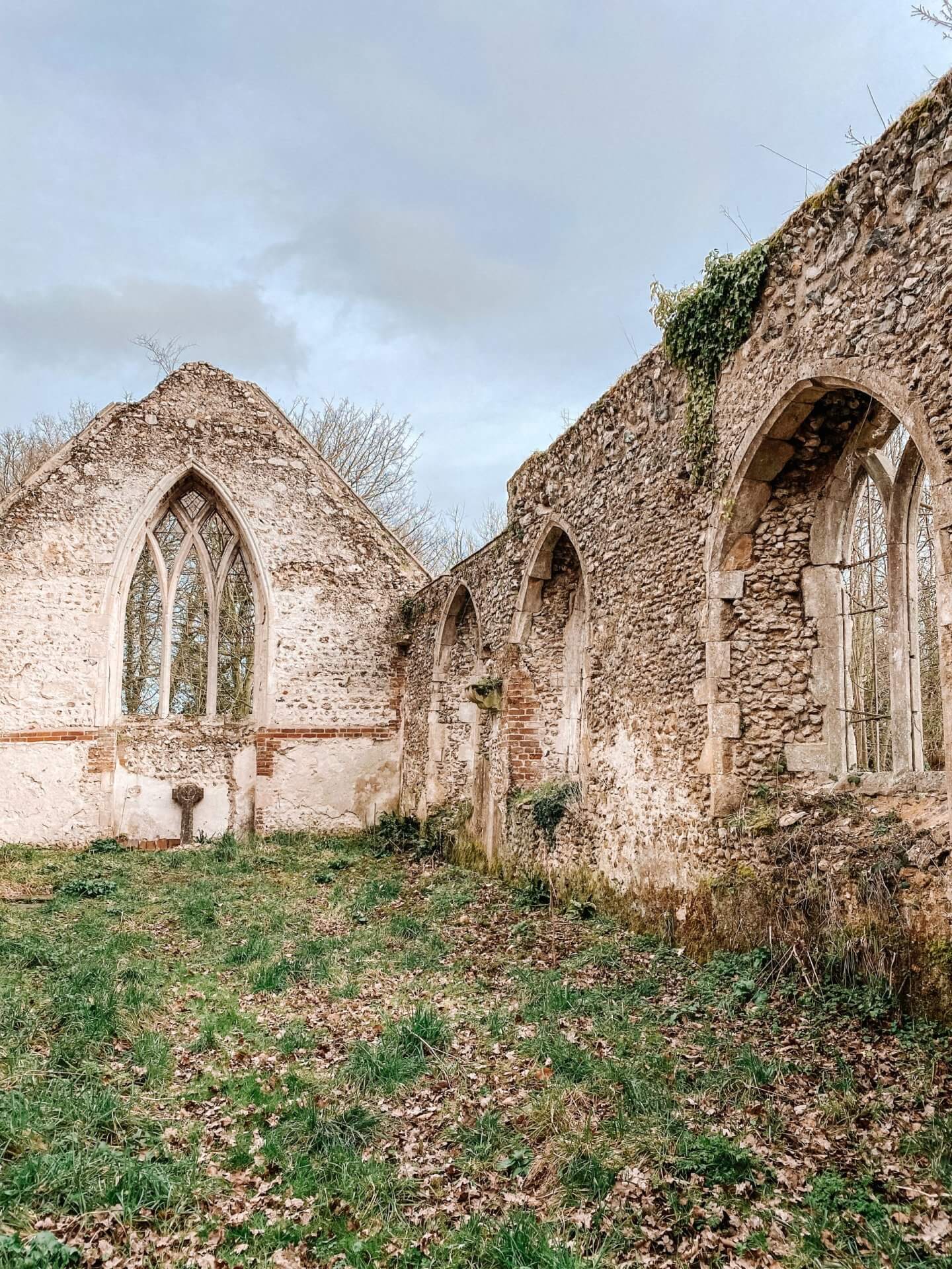
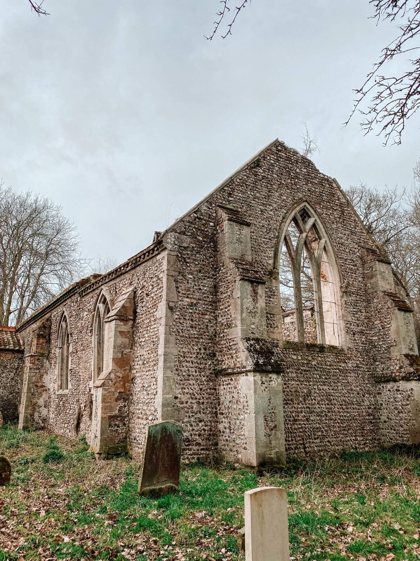
Until 1940, this was a working building and, therefore, a fairly recent ruin. It fell into disuse and was declared redundant in 1946. As was the way back then, the roof was removed as a sign of the building no longer being used as a church. There isn’t a road to the church or nearby buildings other than a couple of cottages. But with a short walk down a dirt track, you will find this well-cared-for ruin. It wasn’t always the way, but in 1993 Norfolk County Council stepped in and cleared the ruin.
Oxwick had lost its tower in the 18th or 19th century, and the area was converted into a vestry that looks a little odd without a roof. You can step inside the church and see the final remains of the glass in the window.
Oxwick, Fakenham NR21 7HY | Map
All Saints, Godwick
These ruins in Norfolk are all that is left of the lost village of Godwick: the tower of All Saints. There was a village here as early as 1086, although it was never large. The medieval village of Godwick is one of 200 that have been lost over time, but most sites have been destroyed by ploughing, the pressures of two world wars or other agricultural uses. Only a few still have impressive surface remains. The earthworks at Godwick are well preserved because the site is grazed and has never been disturbed. Today it is one of the best surviving examples in the county and the only one open to the public.
By the 16th century, only four houses remained in the village. The local Coke family had built Old Godwick Hall and the barn which remains today. The barn was built over the main road of the village, which is another sign it was doomed.
A map from 1596 shows a church with a nave and chancel but no tower, which shows the church was declining with the village, and the tower had been lost by the 16th century. However, the fashion for follies at the time meant that the ruins were used to build the tower that currently stands, most likely by the Coke family.
The tower was almost complete until 1981, when a storm caused the eastern wall to collapse.
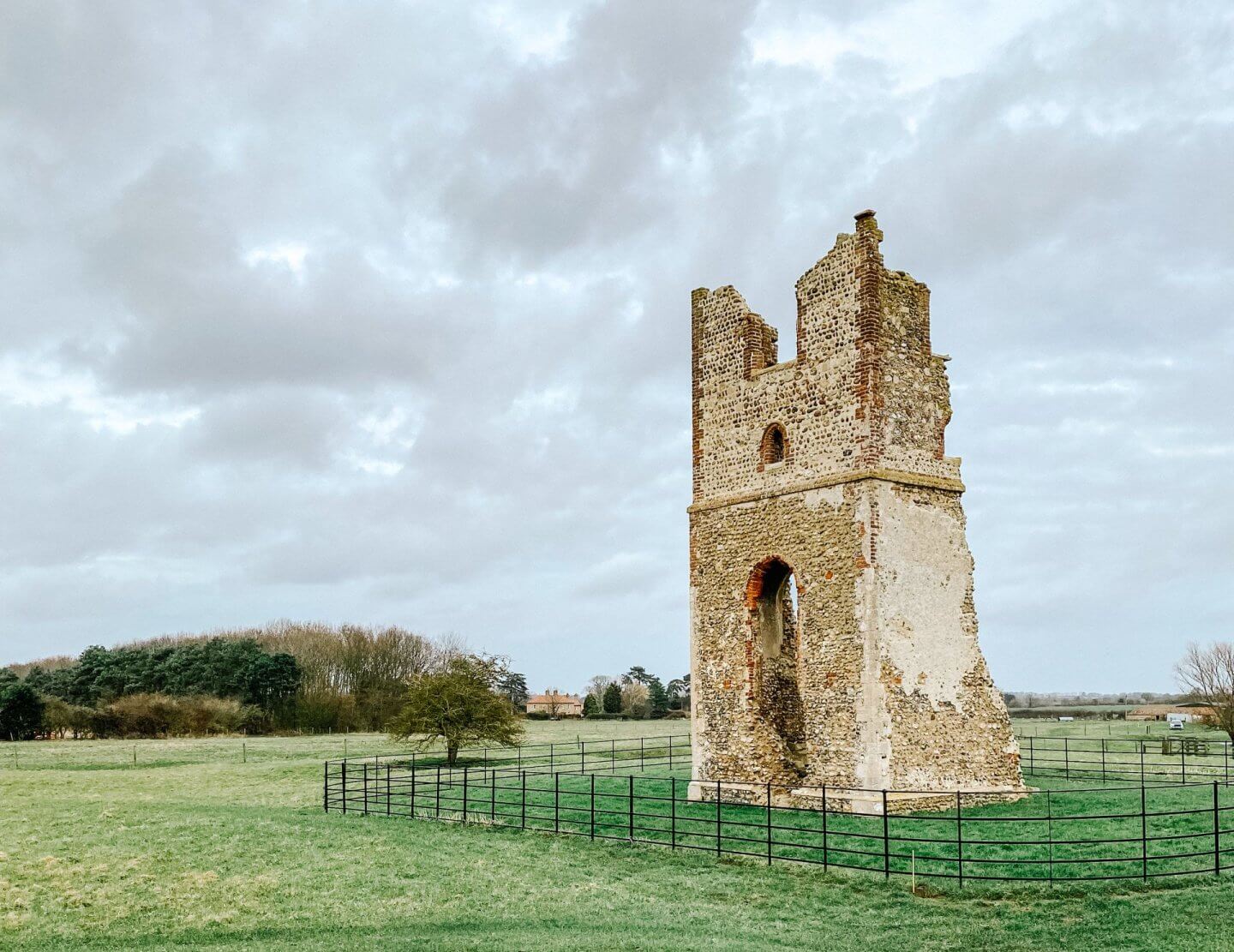
Godwick, King’s Lynn PE32 2RJ | Map
St John, Oxborough
If you had visited St John in early 1948, you would have seen a very large church with a tall, striking 150ft spire. But in the autumn of that year, powerful winds caused the spire to waver and subsequently collapse into the church below, bringing the tower down with it, causing it to join the list of ruins in Norfolk. What was formerly the nave was grassed over, and the remaining church has a new west wall, through which you enter the Parish church.
Surviving the collapse is the 16th-century Bedingfield chapel, which is the resting place for the family who built the magnificent Oxburgh Hall, which is just next door.
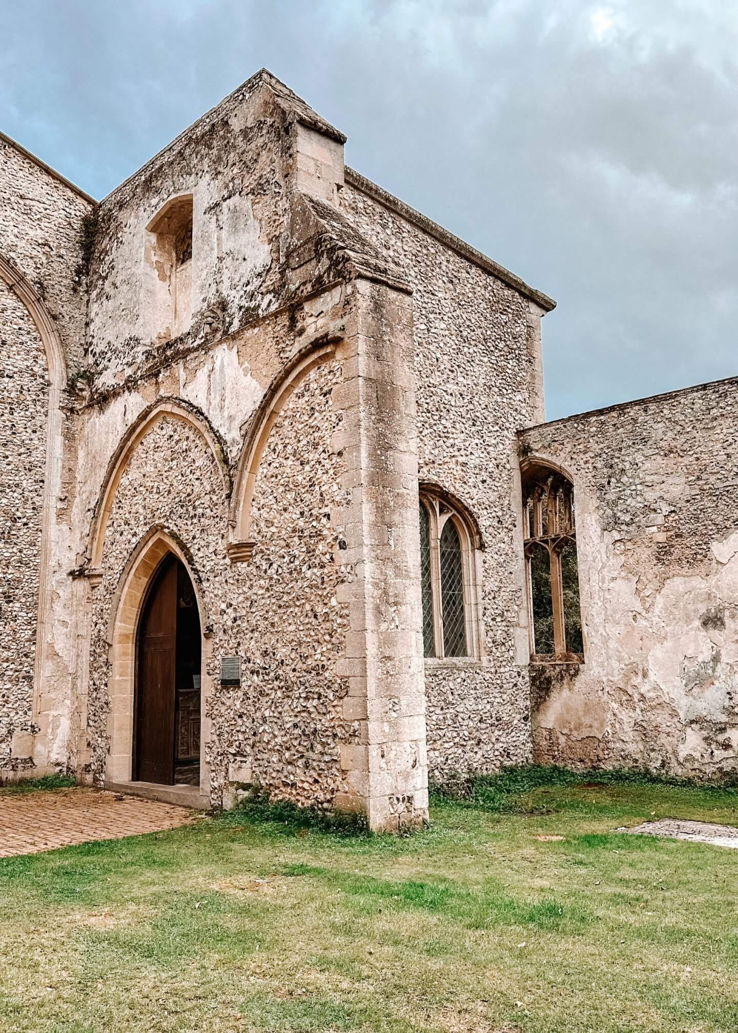
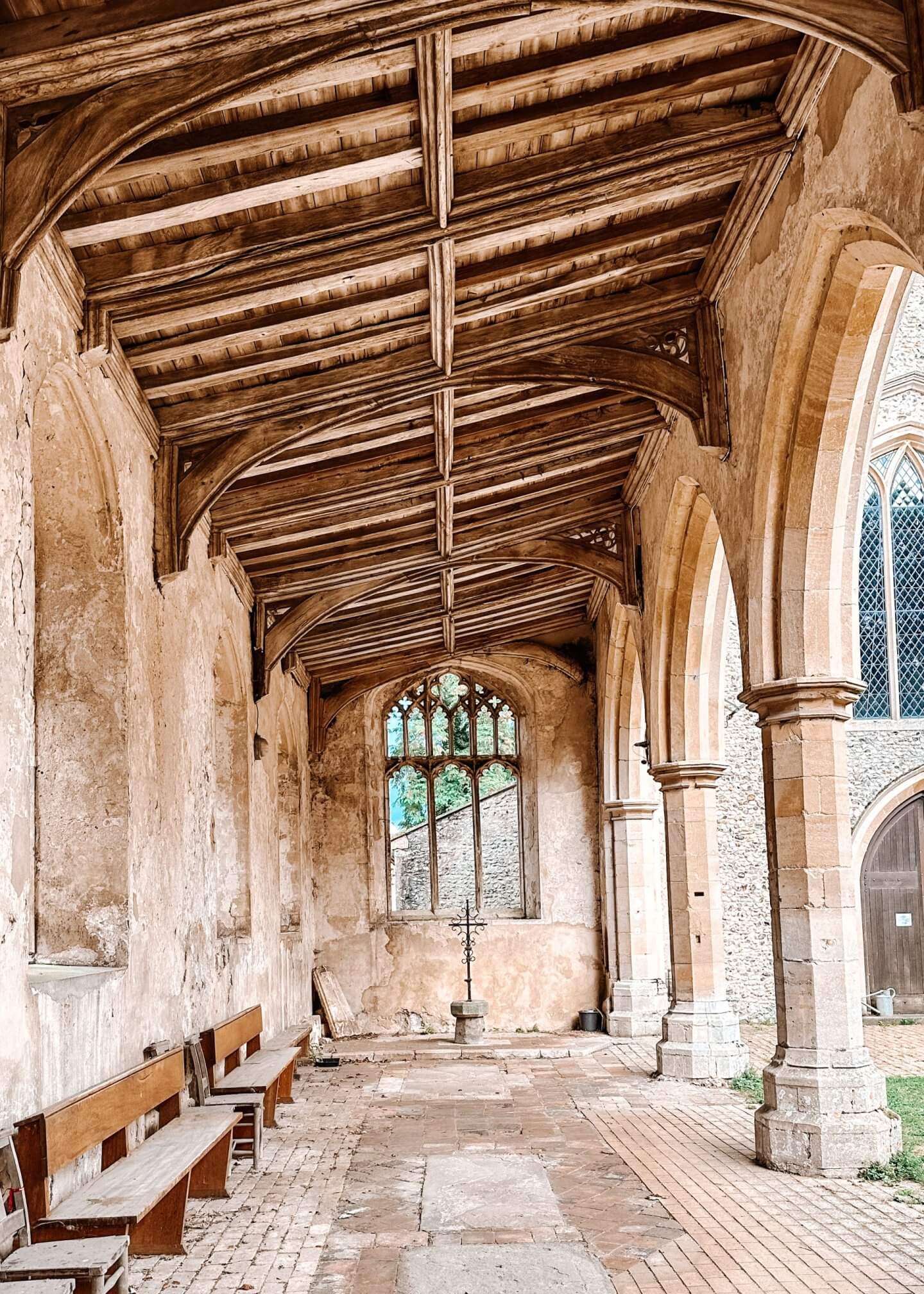
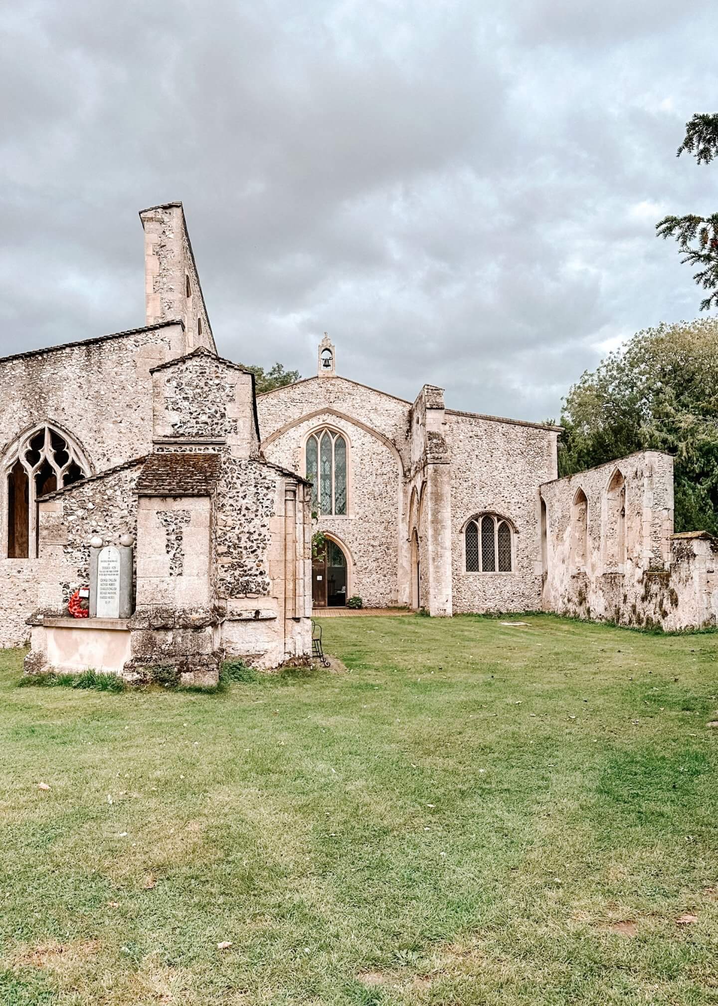
Oxborough, King’s Lynn PE33 9PS | Map
All Saints, Beachamwell
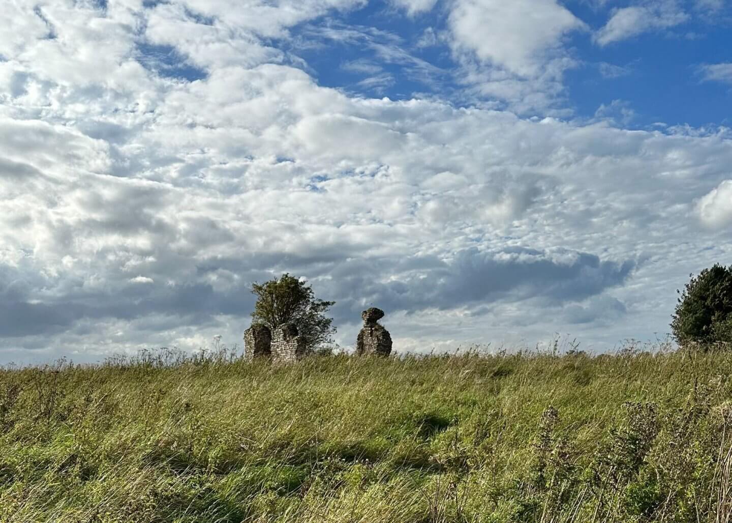
The little village of Beachamwell was once home to four parish churches. Two of these did not survive the Reformation, and one of these was All Saints, Beachamwell. Now all that remains of this former church is a few stumps sitting at the top of a windy hill. It seems that after the Reformation this church was bought by the local Athow family of Wells Hall, to be used as a mausoleum. However, when the family line ended in the 17th Century, the church was left to start its decline to ruin.
There was an arch on the west side that survived, but this finally collapsed in 1989, leaving the stumps we see today to slowly be reclaimed by the land
Beachamwell | Map
St John, Beachamwell
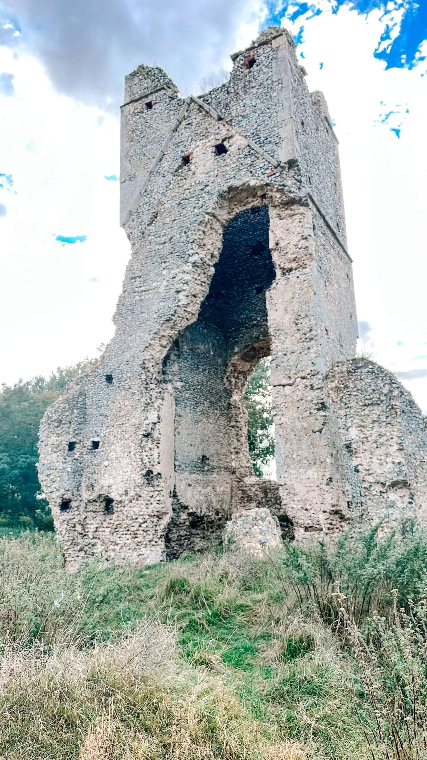
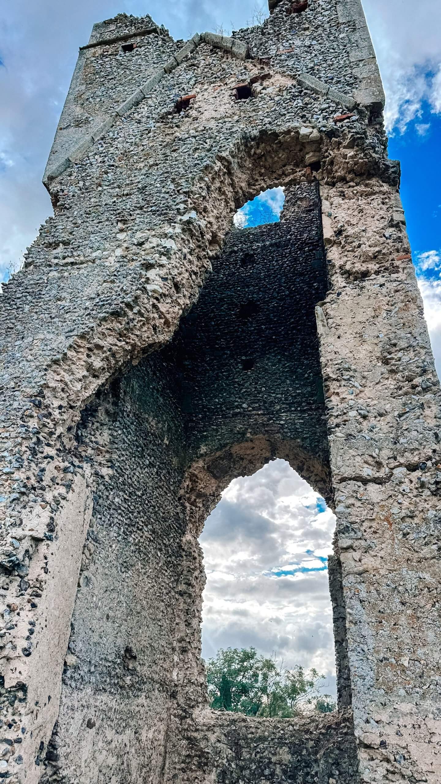
The second of the two ruined churches in the village of Beachamwell. At first glance, it might seem that this one was abandoned later than All Saints, as more of it remains. However, this is in fact not the case. Once again, this church fell into disuse after the Reformation. It was simply a casualty of the fact that Anglican Britain could no longer support these tiny parish churches, created for the nearby manor houses, and so this church was abandoned.
In the 18th century, it appeared that the building had been converted into cottages, but no all that remains is the tower which sheep graze around the base of.
Beachamwell | Map
North Norfolk Area – church ruins in Norfolk
Egmere
Just the tower remains of this one! When this church was built, there were only 13 taxpayers in the village, and then after the black death, this was reduced to 3! Clearly not sustainable for a village church. It was then sold to the nearby Walsingham Abbey and used as a barn. The graveyard was used for grazing sheep.

Little Walsingham, Walsingham NR22 6AX | Map
Binham Priory
This was founded in 1096 and was home to a community of Benedictine monks for 400 years. The nave is still used as the local church for the village. But the ruins surrounding it tell the story of a large and impressive place. However, its history is one of almost continuous scandals. Many of its priors proved to be unscrupulous and irresponsible, and by the time of the priory’s suppression in 1539, the community had been reduced to just six monks. The monastic ruins are open at any reasonable time during daylight hours. The priory church is open daily throughout the summer from 9 am-6 pm and in winter 9 am-4 pm. A very impressive set of ruins in Norfolk.

Warham Rd, Binham, Fakenham NR21 0DQ | Map
Beeston Regis Priory
This little priory is located just outside the town of Sheringham on the North Norfolk coast. It was founded in 1216 for a very small community of 4 canons. Abandoned in 1540 during the dissolution of the monasteries. Most of the stone was taken, but the church remained intact as it was used for farm buildings!

Abbey Farmhouse, Sheringham NR26 8SF | Map
Bromholm Priory
Bromholm Priory, originally known as Bacton Abbey, was a Cluniac priory located near the village of Bacton. It was founded in 1113 by William de Glanville, Lord of Bacton, and was originally subordinate to Castle Acre Priory until 1195. King Henry III visited the priory in 1223 to take the holy waters and dedicate them to the relics.

These ruins are now on private land, in the care of Historic England, but you can still walk up to the north gatehouse and see the central area.
5 Abbey St, Bacton, Norwich, NR12 0EL | Map
St Margaret’s, Antingham
These ruins in Norfolk were some I stumbled across, and don’t appear on any maps! Just outside of North Walsham is the village of Antingham, which is home to two churches on the same spot. One is a ruin standing in the graveyard of the current church. They are both on the same site because there used to be two manor houses in this spot, so one church for each. The ruined church dates from the 12th century and the current one from between 1330 and 1360. They were both in use until after the Reformation, but by the 18th century, both were in a poor state, and the village could not afford to maintain them both. So stones from St Margaret’s were used to repair the current St Mary’s.

Church Ln, Norwich NR7 8AU | Map
St Peter and Paul, Edgefield
In 1883 the pastor decided to demolish this church, which was in poor condition but not unusable. The church was rebuilt, with the same name, on a site nearer the middle of the village. This was not unusual for churches in Norfolk at the time. The octagonal tower is now all that really remains of the church. Standing proud in an overgrown graveyard, surrounded by old farm buildings, it is now one of the ruins in Norfolk.

Hunworth Rd, Melton Constable NR24 2AE | Map
St Mary, Burgh Parva
Burgh Parva was never really more than a hamlet of nearby Melton Constable. When the Reformation came, there was no longer the ability to support two churches, so this was abandoned and left to ruin. However, when the railways arrived, the population of Melton Constable grew, and the village church was located on the estate of the Hall, which would have caused trouble with the villagers. There was a need for an Anglican presence near the town. As such, a temporary corrugated church was erected in the graveyard of St Mary in 1903. And it is still in use today!

Burgh Parva, Melton Constable NR24 2PU | Map
St John the Baptist, Croxton
These ruins in Norfolk are of the church of St John the Baptist. It was abandoned in the 1880s, along with the nearby Fulmodeston St Mary, when a new Fulmodeston church was built in the middle of the two original churches.
The church is being left to be reclaimed by nature and set in a wooden area. There is no roof, and the walls are starting to crack, but it is a pretty ruin to visit.

Croxton Rd, Fakenham NR21 0NJ | Map
Weybourne Priory
These ruins in Norfolk are of the priory attached to the current parish church. They date from the 13th and 14th centuries and are the remains of a small Augustinian priory established in the 11th century. The ruined tower you can still see dates from the 11th century, actually! The 13th-century priory swallowed the rest of the original church. By 1514, there was just the prior and only one canon living here; it was dissolved in 1536. At this point, the current church tower was built.

Weybourne, Holt NR25 7HP | Map
St Margaret’s, Pudding Norton
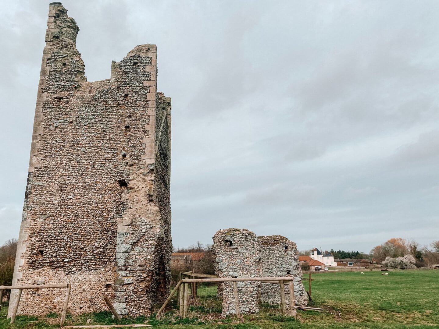
The village of Pudding Norton was abandoned during the reign of Elizabeth I as the landowners wanted to use the land for grazing livestock. The church of St Margaret’s was most likely late Saxon, with the west tower and part of the west nave being constructed in the 12th century and added to in the 13th. It is in a private field, so not easy to access. You can see the undulating land of the ruined village in the field next to the church.
Fakenham NR21 7NB | Map
St Remigius, Testerton
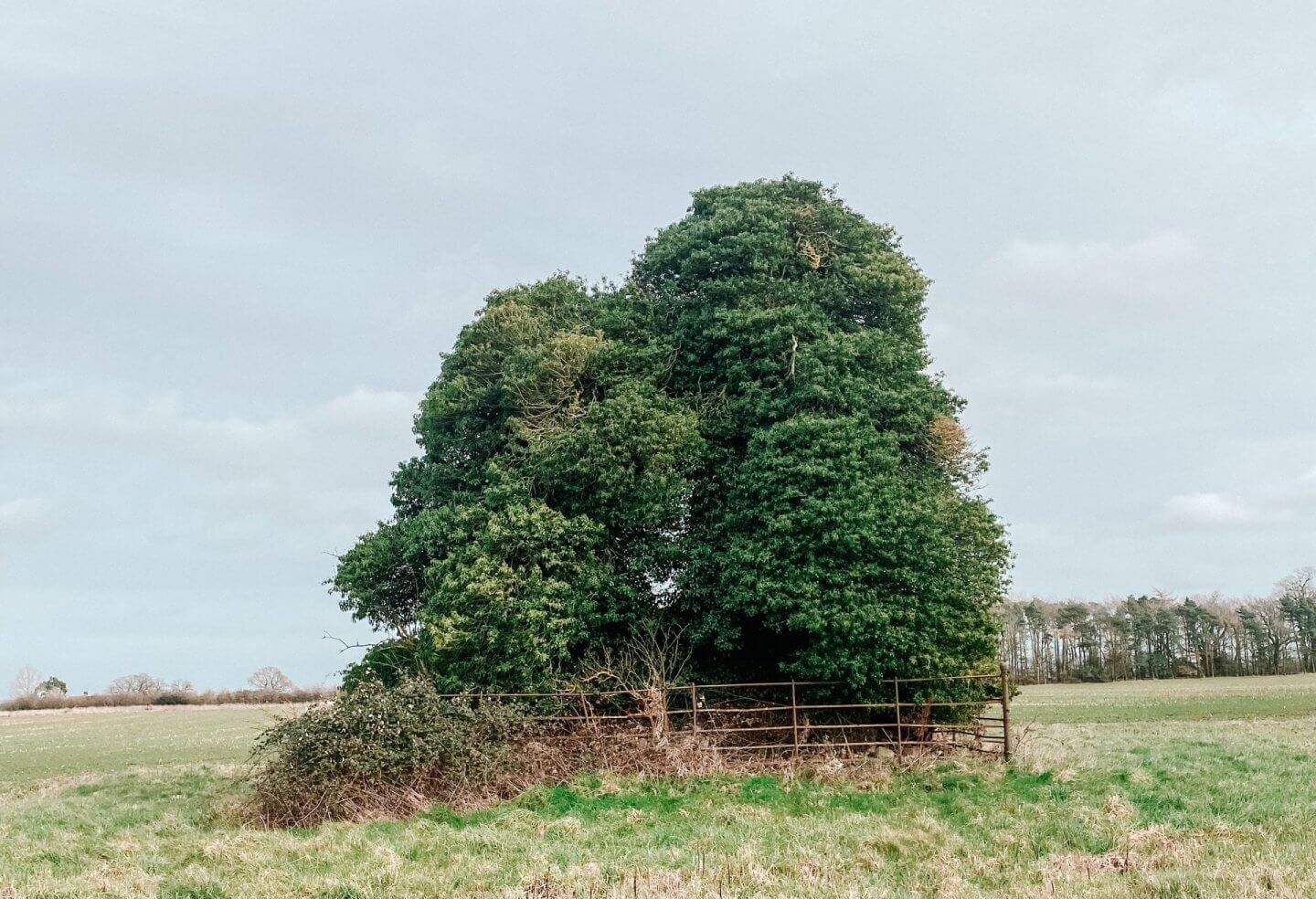
Not one of the most exciting ruins in Norfolk. At first glance, this just looks like a large squat tree. And in fact, even when getting closer, it is hard to see where trees and ivy end and where the church begins. But somewhere buried underneath all the greenery is the little bit of history that belongs to St Remigius. This area south of Fakenham has a lot of ruined churches, and this is another one to add to the area. The tower dates to the late 14th or 15th centuries, though the rest of the church is likely to have dated to the 11th or 12th centuries.
Testerton is one of a clutch of deserted villages and associated churches within a few kilometres of Fakenham. Today the village has only a handful of inhabitants; the civil parish of Testerton was abolished in 1935, and the lands were used to enlarge Pudding Norton, another mostly deserted village. At the beginning of the 17th century, the parish had only 18 members, and the lord of the manor owned all of the lands in the parish. By the end of that century, the church was already very ruined, and the walls were completely removed at some point after this time. What survives of the buildings is the western part of the church’s west tower.
Pudding Norton, Fakenham NR21 7AE | Map
St Margaret’s, West Raynham
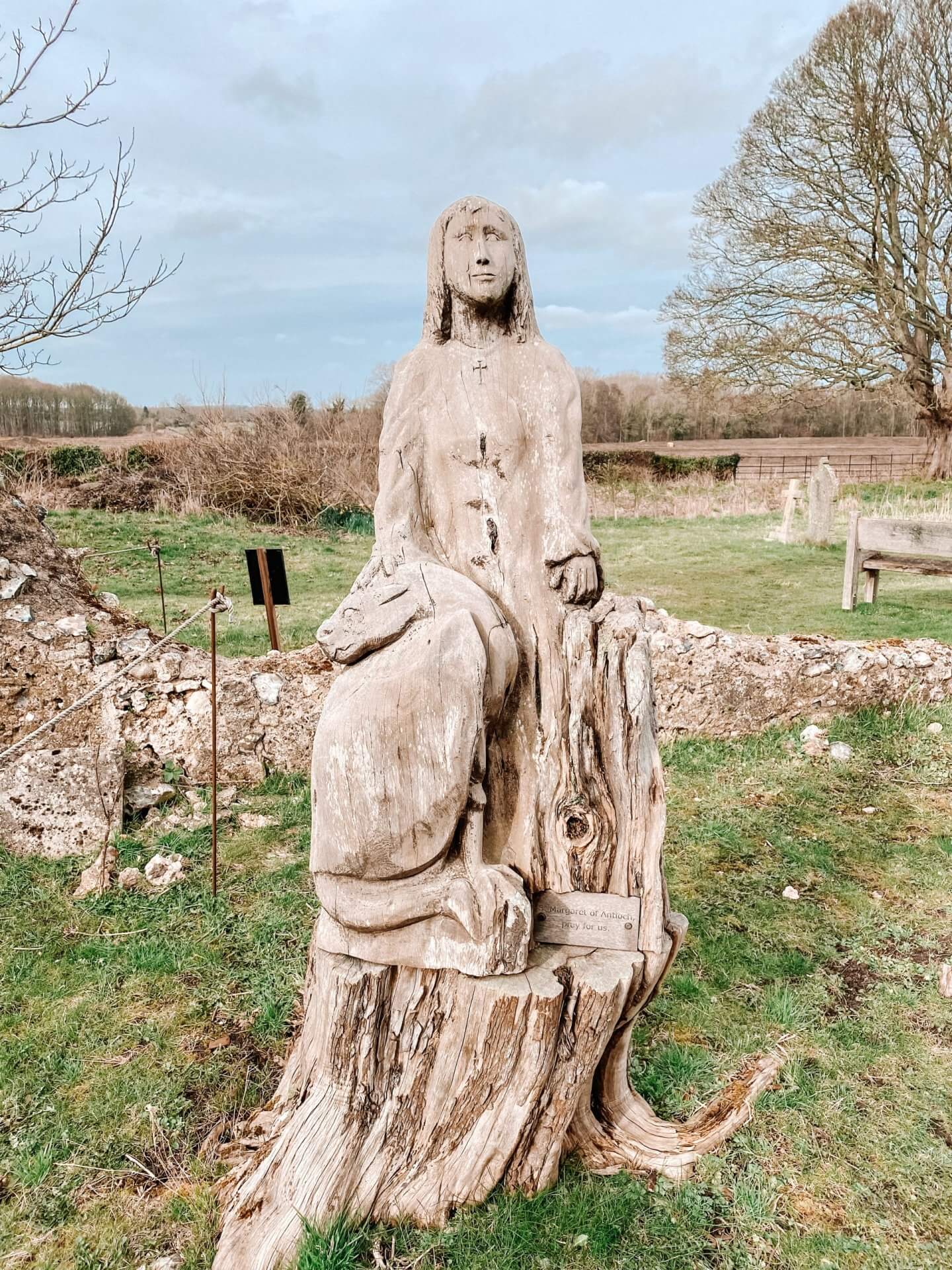
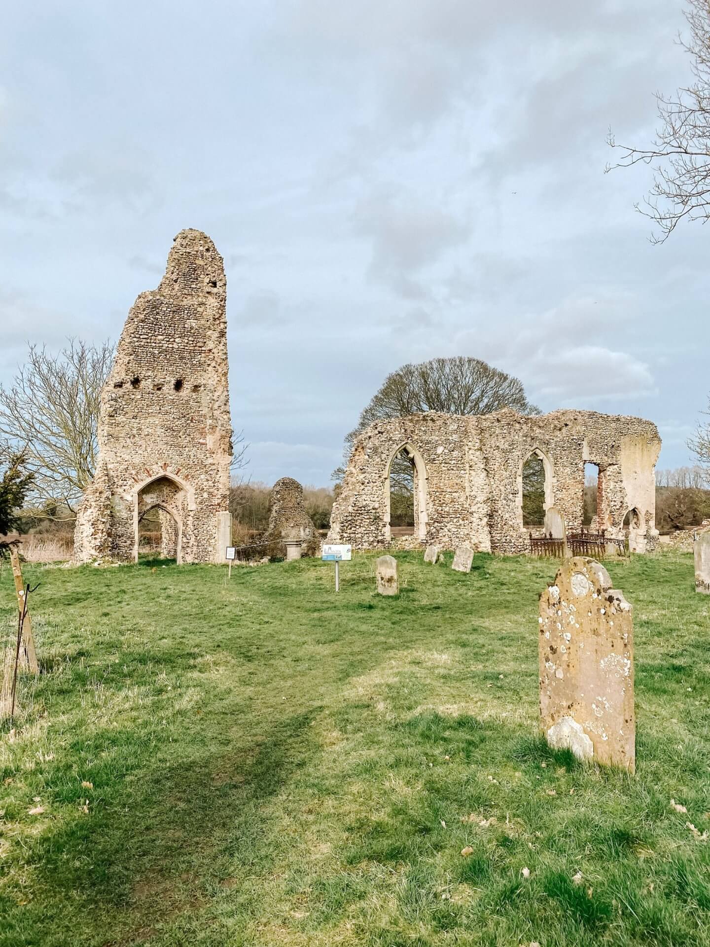
There has likely been a church here since Anglo-Saxon times, although the current building was first built in Norman times and was added to through the 12th and 13th centuries. West Raynham is the largest of three villages comprising the Raynham Parkland, belonging to nearby Raynham Hall. St Margaret was abandoned in the 18th century and consolidated with the church of the nearby East Raynham.
After the church was dissolved, it fell into disrepair. Some remedial work was undertaken in the 17th Century, but by the 18th, it was a ruin, and by the 19th, an ivy-clad building. However, clearance of the graveyard happened in the 1990s, and by 2001, services in the church had resumed. The original font is still used for baptisms, and the ruin is now home to a modern brick-built altar. Services must rely on good weather!

West Raynham, Fakenham NR21 7EZ | Map
Norwich Area – church ruins in Norfolk
St Michael’s, Bowthorpe
This ruin is the last remaining building of the old medieval village of Bowthorpe. Nowadays, as the city has grown, it feels like it is located in a very urban setting, making it different to any of the other ruins in this post. The village of Bowthorpe was first recorded in the Domesday Book of 1086, with 14 villagers. Excavations have shown that a church stood in this spot at this time. However, the first written records of the church are not until 1306. A renovation took place in the 1400s, and this building remains ruined to this day. By the early 1800s, the church had fallen into disuse. The tower was then used as a chimney for a brick-filled oven. And in fact, during excavations in the 1980s, a skeleton was found in the oven! By the early 1900s, the church was used to house pigs.

Today, the ruin and the gardens are free to wander around. It is not a huge ruin or space, but one worth popping into!
Norwich NR5 9AA | Map
St Bartholomew, Heigham, Norwich
One of five medieval Norwich churches to be hit in the raids by German bombers during WWII. Two were destroyed, two only the tower remains, becoming ruins in Norfolk, and one was rebuilt. St Bartholomew was one of the ones where just the tower remains. Photos from 1938 show the church still in use, surrounded by a graveyard. Almost three years later, on the night of Monday, 27th of April 1942, St Bartholomew was pretty much destroyed by the German bombing. This was the first of the great Baedeker Raids on the city, when the Germans took revenge on historic British towns and cities for the Allied destruction of Lübeck the previous month.
The tower only just survived, and it was secured in 1953. And now, it sits in a little park for the community.

Church Cl, Norwich NR2 4EF | Map
St Benedict’s, Norwich
The second of the bombed churches in WWII, where only the tower survives, of the ruins in Norfolk. All that remained of St Benedict’s was the shell of the tower. It now stands in the middle of a courtyard of modern flats—a reminder of this historic part of the city that only just survived the raids.

48 Wellington Ln, Norwich NR2 1HG | Map
St Bartholomew’s, Norwich
Hardly anything remains of this church, so perhaps not the most impressive of ruins in Norfolk; however, it has an interesting story to tell. It was once the parish church of Conesford, a suburb of medieval Norwich. The church was abandoned by the 16th century and, at some point, was turned into a factory. By the 18th and 19th centuries, this area was home to warehouses, factories, and the slums that were associated with them. Now, it sits on the edge of the pavement, and just a stump remains. Housing covers the area where the rest of the church would have stood.

74 Ber St, Norwich NR1 3ES | Map
South Norfolk Area – church ruins in Norfolk
St Saviours, Surlingham
These church remains may be where my fascination with ruins in Norfolk began. Surlingham is the village I grew up in, and so this ruin featured on many a walk of my childhood. Even after moving away from the village, this still remains one of my favourite walks, and I often come back. My mother was even on the committee to help preserve this building!

The ruins of St Saviour’s church, Surlingham, are a prominent and stunning landmark overlooking the marshes of the Yare Valley. The church was an early Norman church. Originally, there were two parishes in Surlingham, and St Saviour was linked to the nearby Surlingham Manor. By the 13th century, it was under the control of the Abbess of Carrow Abbey. The parish’s population subsequently declined, and eventually, St Saviour was absorbed into the parish of St Mary in 1705. It gradually declined, and the process was sped up by robbing the church for building materials. It is also the final resting place of several residents, including ‘the people’s naturalist’ Ted Ellis (1909-1986), writer, curator and founder of Wheatfen nature reserve. St Saviour was repaired and preserved in 2011.
Park at the nearby St Mary’s church, and walk around the church with it on your left. Turn left at the junction and walk down the track to find the ruins.
Surlingham, Norwich NR14 7DF | Map
Saint Wandregesilius, Bixley
Located up a little lane, you will come across these ruins in Norfolk of this old church dating from 1272. Unusual in its name already, with the long saint’s name. This church is a relic of a village almost disappeared. In May 2004, arsonists deliberately set it on fire and gutted this church. It is believed they used the gas canisters that were on site for the heating to start the fire. Being deliberately destroyed seems a really sad way for a church to go and become one of the ruins in Norfolk!

Bixley, Norwich NR14 8RY | Map
St Martin, Shotesham St Mary
This church is one of 4 medieval churches that used to exist in this village! In early medieval times, this small village was prosperous enough to have four manors and, therefore, four churches. Both All Saints and St Mary are still in existence to this day. St Botolph, a mile away, is simply some raised ground, but St Martin is a rather more substantial and impressive ruin, sitting a hundred yards away from St Mary. After the Reformation, the focus was on congregational worship rather than sacramental devotion, which meant no need for the many churches anymore. St Martin had to go. The church was simply abandoned, with the roof used for other buildings. In 2006 this was one of the churches Norfolk County Council cleared to save.

Hawes Green, Norwich NR15 1UW, | Map
St Mary’s, Saxlingham Thorpe
This church probably originated from the late Saxon period. It seems its ruin came from repairs to the building, simply stopping somewhere around 1684. By 1687 the building was ruinous, with materials being used to repair St Mary’s Church in nearby Saxlingham Nethergate.
Although the ruins are substantial, they are surrounded by trees in a wooded area, making it fairly hard to spot! This gives it quite a mysterious and eerie vibe.

Saxlingham Thorpe | Map
St Mary’s, Tivetshall St Mary
This was one of my favourite ruins in Norfolk! There were two villages here historically, which became one. As such, there wasn’t much of a need for two churches. While the church at Tivetshall St Margaret is frequently used and loved for its sixteenth-century tympanum and rood screen, its sister church at Tivetshall St Mary is now a ruin. Even before its final abandonment in 1940, it was described as a ‘plain building’. Even as far back as 1702, it was recorded that the church ‘is fallen into great decay’. However, its final demise came in 1947, when the tower collapsed into the nave. This was caused by vibrations from an aircraft flying too low! The War Damage Commission wouldn’t make any payment for damage caused by the event.

Today, the ruin is a peaceful one. The graveyard is still maintained, and the tall, perfect east window, now glassless, looks out over the fields. There is even a visitor’s book in the porch to sign.
Tivetshall St Mary, Norwich NR15 2DF | Map
All Saints, Gillingham
This one felt quite spooky! It was a grey, misty, overcast day when I visited, and the tall, imposing tower, covered in ivy, hides among the trees. Only the tower remains of All Saints’ church, which sits in the graveyard of the existing church. The village still wanted to spend money on All Saints in the 1470s because several bequests survived from that time. However, after some enthusiasm towards the restoration of the church in 1660, it then fell into disuse. By the mid-18th century, it was a ruin. The stones from the nave and chancel must have been taken away pretty quickly and used for building materials because there are several 18th-century headstones where the nave used to be.

Gillingham, Beccles NR34 0ND | Map
All Saints, Keswick
A half ruin this one, as there is a ruined church, with a small complete church right next to it. It is right on the edge of Norwich but feels like it could be in the middle of the countryside. The church fell into disuse in the 16th century when the religion changed from Catholicism. However, in 1598 Henry Hobart bought the nearby manor houses of Intwood and Keswick. He used stones from this church to build a chapel at Intwood Hall. The Gurney family restored All Saints to use as a mortuary chapel three hundred years later. Only in the 1920s was the chapel refurbished and used as a church, nearly 400 years after its last service!

Keswick NR4 6TP | Map
St Andrew’s, Whitlingham
This church is not the easiest to find. You need to take the road to Whitlingham Country Park, at the turn-off opposite Trowse Newton church. Drive past the broad and stop just before the bridge under the A47. It might seem that there is no church to be seen, but if you look up at the hill to your left, you should spot some ruins perching precariously on top of a hill.

These are the ruins of St Andrew’s, Whitlingham. It fell into disuse in the 17th century but became a popular romantic spot for courting Victorian couples. Indeed, window tracery was added in Victorian times to an already ruined church to make it even more romantic. The tower collapsed in the 1940s, and in 1997, the East Wall was demolished as it was deemed unsafe.
It would have been tranquil, except the A47 thunders past just behind it. The ruin itself isn’t easy to access; you can scramble up a steep hill or climb a locked gate. To the right of the ruin, you can see moss-covered remains and rubble where they tumbled down the hill.
Whitlingham Lane, Norwich | Map
St Mary’s, Thorpe Parva
The village of Thorpe Parva was mentioned in the Domesday Book but was deserted by the medieval period. Now only the church of St Mary’s and the Hall remain. The parish was combined with the nearby village of Scole in 1482, and the church was abandoned in 1540. The church’s tower only survived as it was converted into a dovecote. It is an easy ruin to find, standing alone in a field. And visible from the road between Scole and Diss.

Scole, Diss IP21 4HJ | Map
St Andrew, Bickerston
Not the most interesting of the ruins in Norfolk and not the easiest to find. Two flint walls are standing in a field, but the banks of the road are high, making it hard to stop as you drive past. But this is the ruins of St Andrew of Bickerston, another medieval village that no longer exists. Most likely Norman, but there isn’t much record of this church, which means it most likely fell into disuse before the Reformation.

Barnham Broom, Norwich | Map
Wymondham Abbey, Wymondham
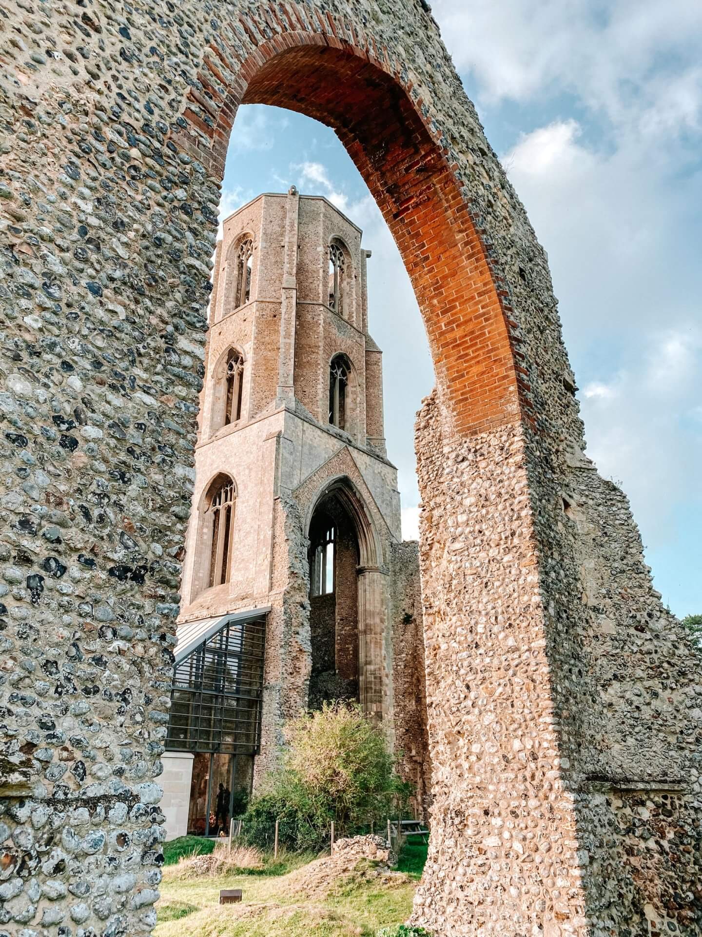
Wymondham Abbey started as a Benedictine Priory, founded in 1107 because, after the conquest, William I granted the lands of Wymondham to the Duc d’Albini. Part of the project was to build a massive Priory church. It was intended that the church would serve the parish and the priory. The town used the north aisle and nave, and the monks used the south aisle and chancel. Disputes between the town and the monks were quite common, and in 1448, it became an abbey in its own right.
The dissolution of the monasteries brought about the closure of Wymondham Abbey. The church was then solely in charge of the parish, and the eastern parts apart from the tower were demolished.
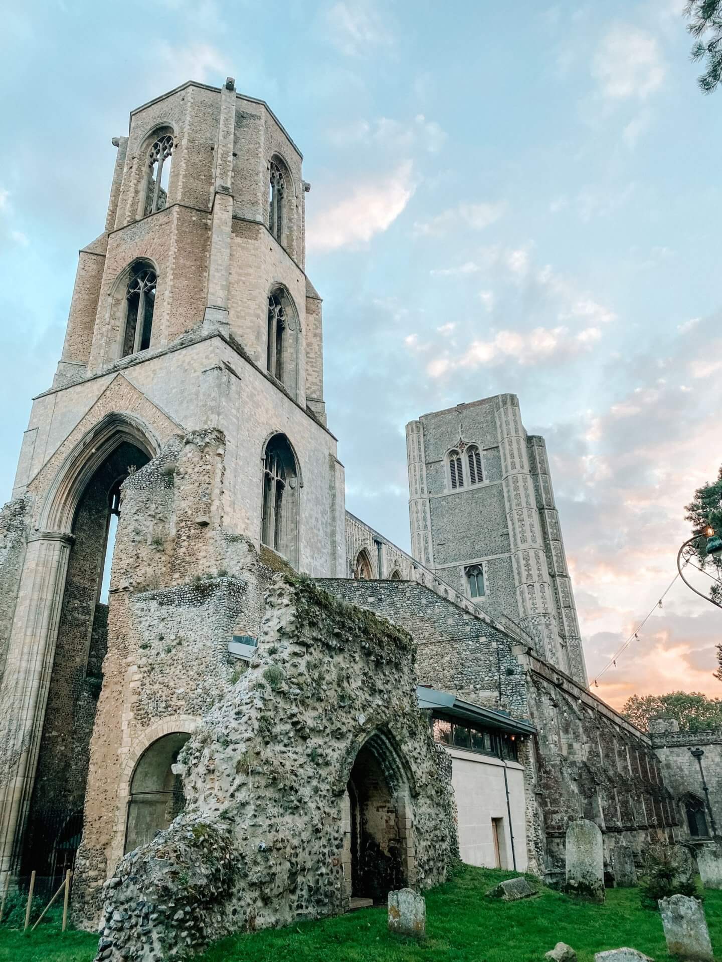
Church St, Wymondham NR18 0PH | Map
St Mary, Kirby Bedon
This church survived the Reformation but fell increasingly into disuse. It was eventually abandoned in the 17th century due to its proximity to the other medieval parish church across the road. The tower was built in the 12th century against an older church. This was, in turn, elaborated upon and added to in the 13th century, and then a bell stage was added to the tower in the 15th century.
Since the early 2000s, this church has increasingly become more ruined. You used to be able to wander around the nave, and the north and east walls jutted high to the medieval portion of the tower. Only one side now remains, and piles of rubble are at the base, as it is further destroyed in storms and bad weather.
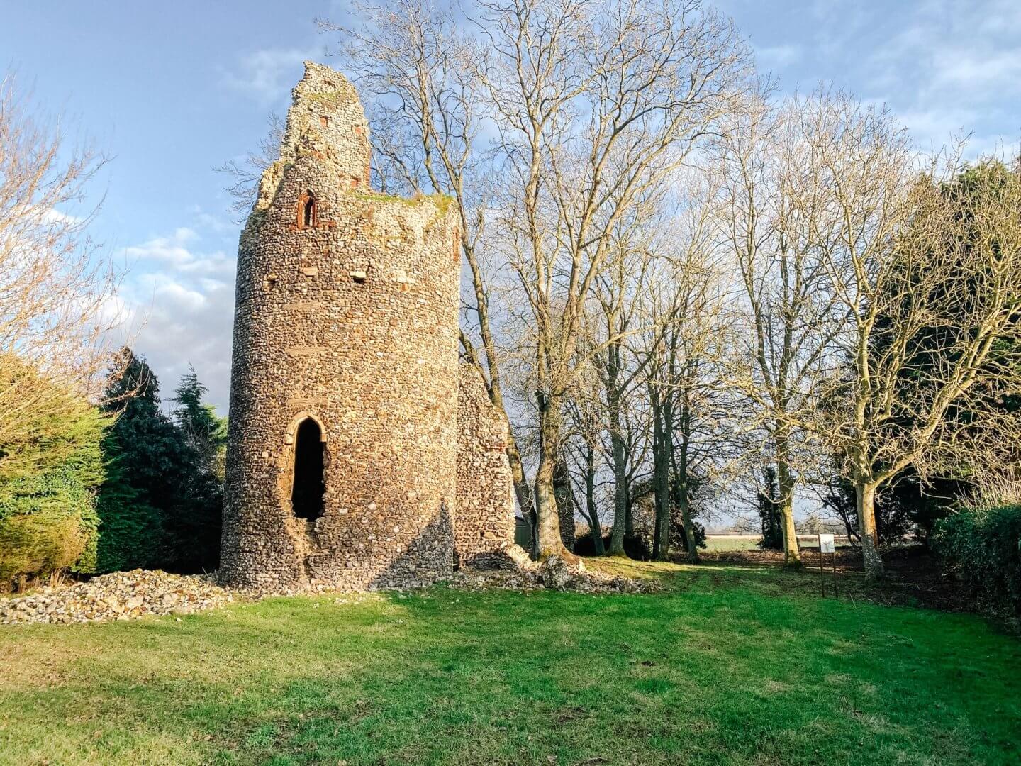
Kirby Bedon, Norwich NR14 7DX | Map
St Mary, Great Melton
The ruin of St Mary in Great Melton sits in the graveyard of the current church of All Saints. The two churches were independent until they consolidated in the early 18th century. After the consolidation and until the 1880s, St Mary was used as the church for the village, and All Saints was left to all but ruin. However, the Anglican revival encouraged the parish to restore the fortunes of its church by rebuilding All Saints on a grand scale, and St Mary’s was demolished for materials. The 15th-century tower left is so similar to the one belonging to All Saints that they may have been built simultaneously.
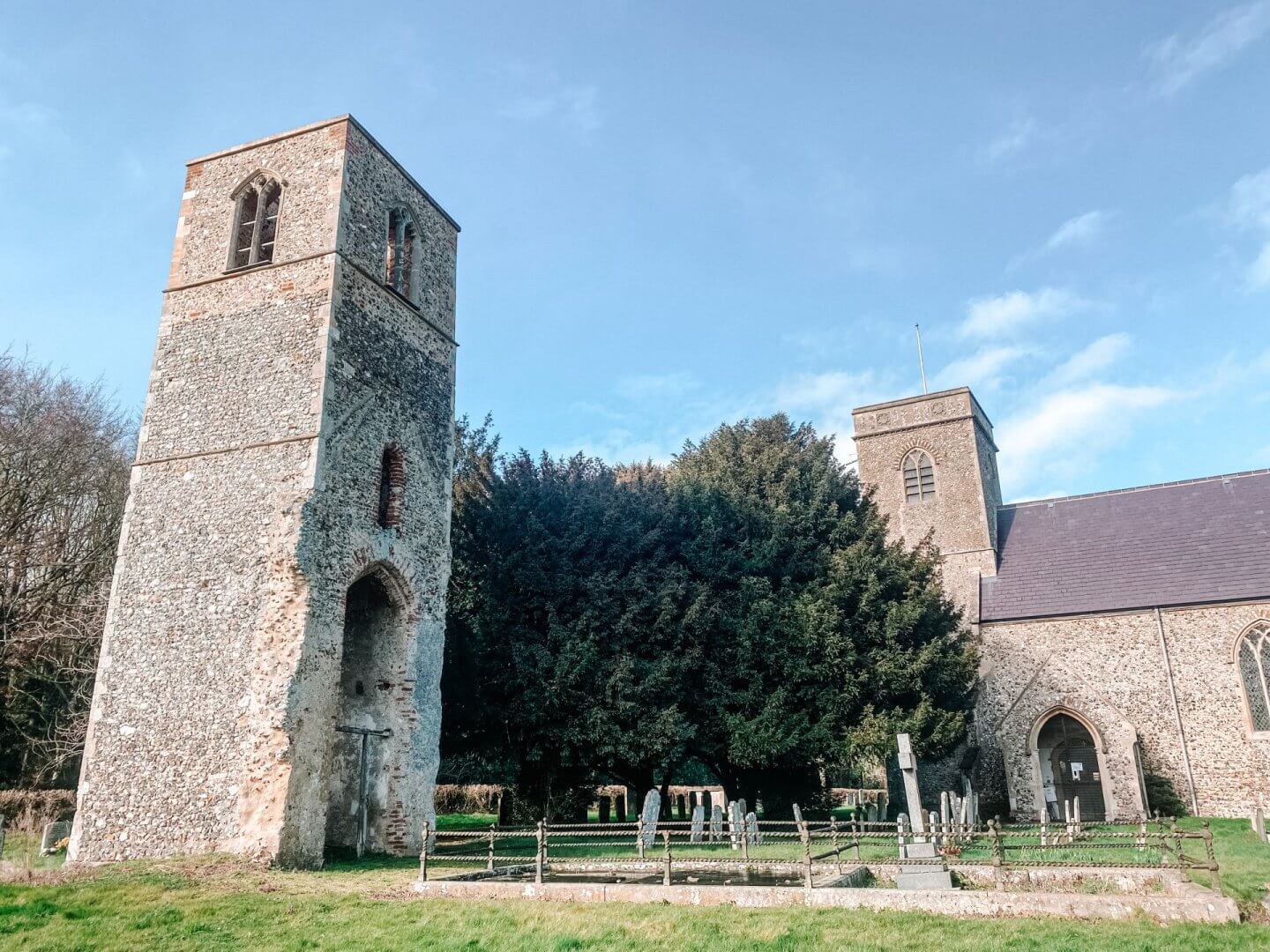
Market Ln, Great Melton, Norwich NR9 3BH | Map
Great Yarmouth Area
St Mary’s, East Somerton
This is an incredible ruin and probably the most dramatic of all the ruins in Norfolk I visited. It is so overgrown and covered in ivy that it is incredibly easy to miss despite being right by the road and huge! It was built in the 15th century and was originally in its own parish. Over time, this was absorbed by the nearby, larger parishes of West Somerton and Winterton. After this, St. Mary’s was used as a chapel for the residents of Burnley Hall until the 17th century before it fell into disuse.
The most striking thing about this ruin is the huge tree that grows straight up through the centre of it. Folklore tells the story of a witch with a wooden leg who was caught and buried alive in the church. The oak tree grew and ruined the church from her wooden leg, coaxed by her vengeful spirit. Now, it is said if you walk around the tree three times, the vengeful spirit of the witch will be released. Other spooky reports tell of monks, often angry, wanting the church to be left alone.

This church ruin has a special feel to it, and if you only visit one – this should be it!
Back Rd, East Somerton, Great Yarmouth NR29 4DY | Map
St Benet’s Abbey
One thousand years ago, this isolated spot on the river banks of the Bure was a thriving monastery. The origins of this abbey are a little mysterious. And when Henry VIII destroyed all the monasteries, this was the only one that survived. However, shortly after, the buildings began to disappear. The Bishop of Norwich has remained the Bishop of St. Benet’s. And there are still services held at the site at Easter. Nowadays, ruins of the old monastery remain to show just how vast the site was. But the most impressive building left is the windmill a farmer built inside the abbey gatehouse in the 18th century.

Great Yarmouth NR29 5NU | Map
St Olave’s Abbey
These ruins in Norfolk are the remains of a small Augustinian Priory. It was founded in about 1216 and named after the patron saint of Norway. The priory was dissolved in the 1530s. Now managed by English Heritage, it is a lovely little spot to visit. The area is small, so it wouldn’t take long to take in the whole site. The undercroft of the abbey was even turned into a cottage at one point in the 1800s!

Norfolk, Beccles Rd, Great Yarmouth NR31 9HE | Map
St Margaret’s, Hopton
This 14th and 15th-century church sits right in the middle of the village of Hopton. It was destroyed in a fire in 1865 and has stood abandoned ever since. In 2014, a project involving on-site training and volunteers from the local community cleared it and made it safe so the village could enjoy it.
4 Coast Rd, Hopton, Great Yarmouth NR31 9BT | Map
St Peter’s, Bastwick
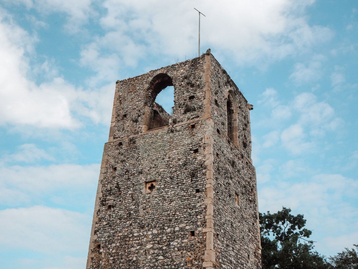
This church was another casualty because Norfolk had too many churches at the time of the Reformation. It is a 14th- and 15th-century chapel that was in ruins by 1618. Only the tall 14th-century tower now remains as part of this tiny village. It is private land, so you can’t get too close, but you can see it standing proud. At one point, about 100 years ago, it was turned into offices, but now it is just an empty ruin once more.
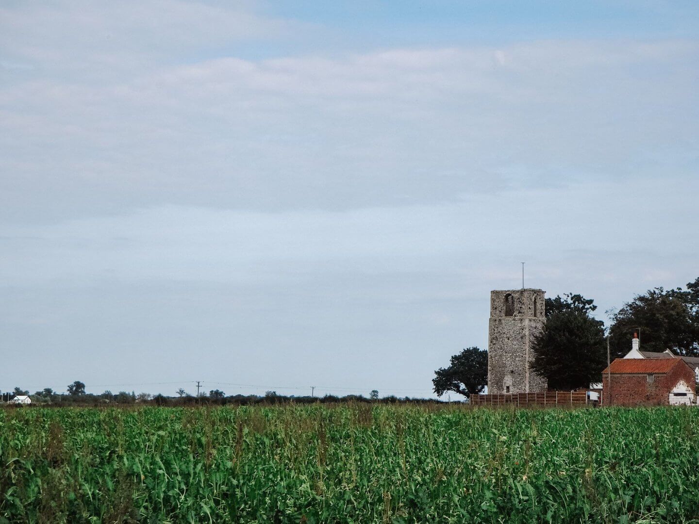
Bastwick Tower, Tower Road, NR29 5JN | Map
St Mary’s, Burgh St Mary
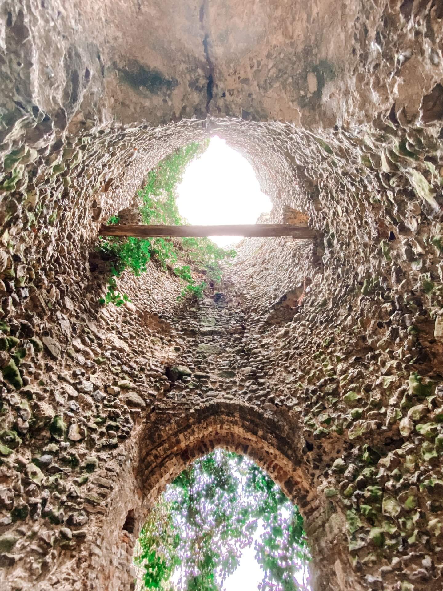
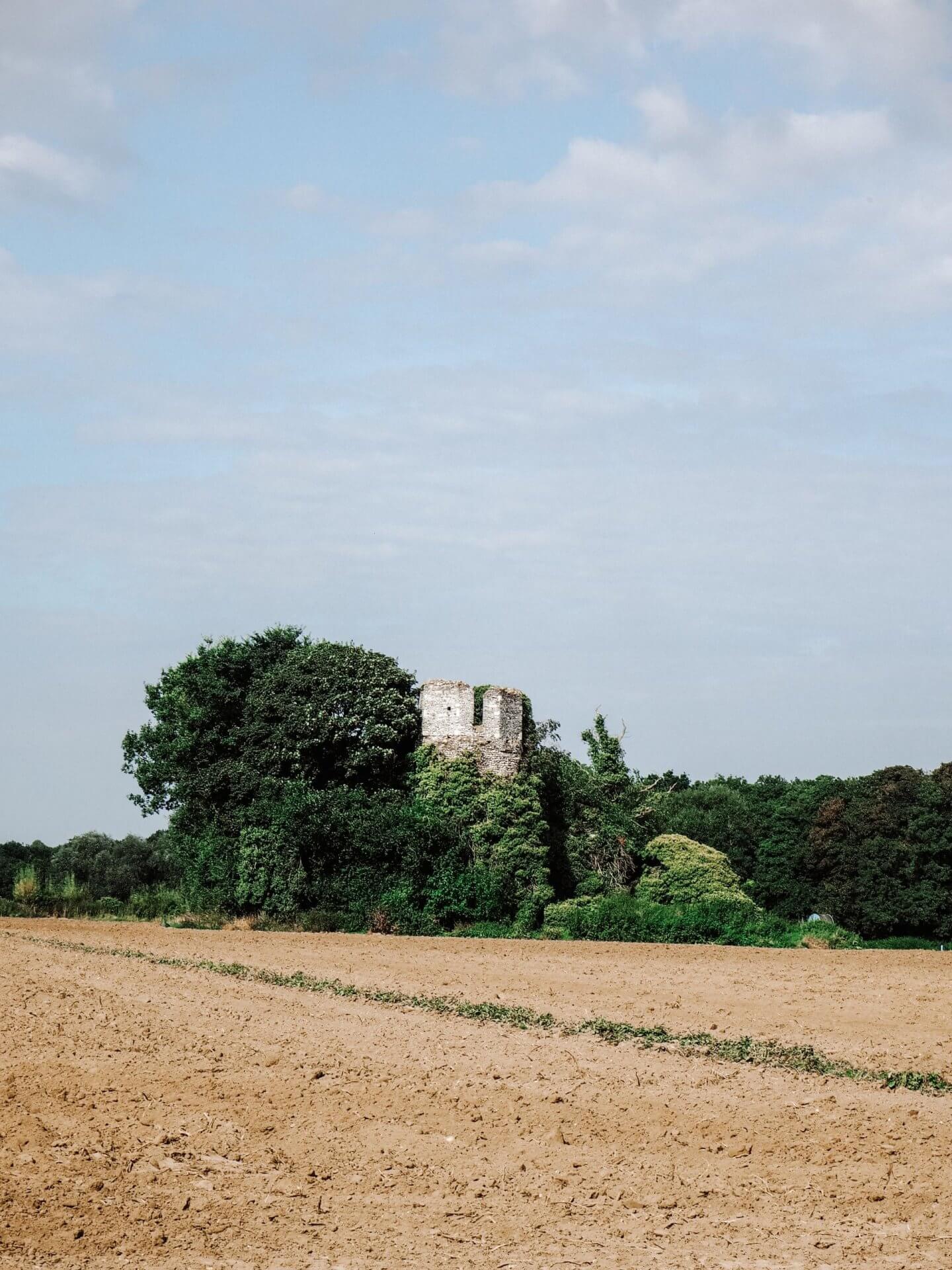
St Mary’s church was once the church of the former parish of Burgh St Mary. It is located in the middle of a field, and while the map seems to suggest a path, this had long been ploughed over. The church ruin is located amid many trees and is home to jackdaws, giving it a spooky feel. The parish here is adjacent to Burgh St Margaret, and after the Reformation, this was the church which fell into disuse.
The tower and nave were probably built in the 11th or early 12th century, and the belfry stage of the tower was added in the 15th century. Until 1554 both churches had their own Rectors; then just one Rector looked after both. Ironically, St Margaret was almost completely rebuilt in the 1870s, so more of the medieval St Mary survives than of St Margaret, despite this being the ruin! By 1602 there was a report that the church had decayed and was turned into a barn.
St Mary’s, Burgh St Mary, Fleggburgh | Map
All Saints, Billockby
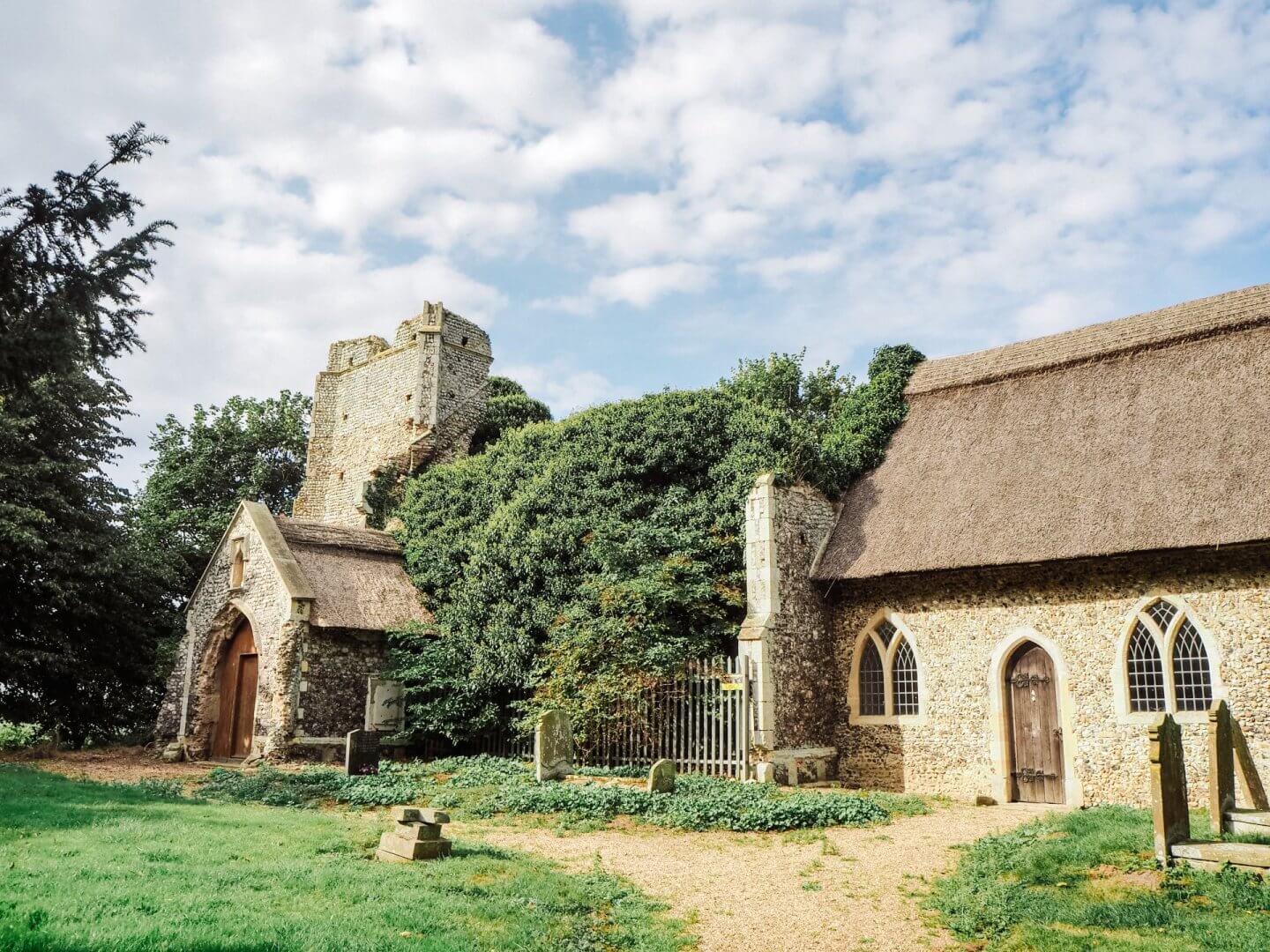
In 1762 lightning struck the tower, leaving a very large crack down the middle. It must have been quite spectacular, and the falling debris of rock and rubble destroyed the nave. This meant all that was left was the chancel. This proved to be all the congregation needed for a church; they made it safe and used it for services until 1872, when a full-scale restoration of the chancel was completed, and it is still in use today. The rest was left as a picturesque ruin.
The south porch survived the destruction and can be seen sitting in front of the ruined portion. The remaining chancel looks like a little thatched cottage. Due to falling rubble, you can’t stand inside the ruins, but if you walk around to the back, you can see where the lightning struck the tower.

Church Ln, Billockby, Great Yarmouth NR29 3BH | Map
Broadland Area
St. Theobald’s, Hautbois
A little tricker of the ruins in Norfolk to find, but worth it. Located down a small path about half a mile from the main road are the ruins of St. Theobald’s. It was ruined in 1890 when the Victorians decided the location was inconvenient and built a replacement church in the centre of the village. This church dates back to the 11th Century, with some medieval additions. It has been de-roofed, except for the chancel.

Great Hautbois Rd, NR12, Norwich NR12 7JZ | Map
All Saints, Panxworth
Only the tower remains of this 14th-century church, standing alone and proud in the graveyard. Little is known about the church, except that it seems to have been in disrepair as early as the 16th Century.
Panxworth was always a small village, and the church was located quite a distance from the main part of the village. Ranworth church is also nearby, which probably contributed to falling congregations. In 1847, villagers paid £500 to add a new nave and chancel. However, once again, the village could not support the church, and by 1969, it was again derelict. The Church of England decided to pull down the Victorian nave and chancel, but once again, the tower was saved! Reports in the 1980s suggested it was used as a meeting place for Satanists! This tower seems to have defied the odds; in 2005, it was struck by lightning, but funding meant it was saved once again.

Panxworth Church Rd, Ranworth, Norwich NR13 6HS | Map
Suffolk
A little bonus church over the border in Suffolk! So not technically ruins in Norfolk, but it is a great one.
St Andrew’s, Covehithe
There was once a quintet of impressive medieval churches in this part of Suffolk. Southwold is the most complete and the best example of what they would have looked like. Blythburgh has been restored, Walberswick is yet another ruin, and Easton Bavents has been lost to the sea when almost the entire village went over a cliff.
However, parts of the original church at Covehithe remain. The large curtain of walling is almost complete, showing this church’s huge size. Inside now sits a smaller 17th-century church, which still uses the same tower as the original. The eastern end of the ruin is especially impressive, with the rood loft stairs in the north wall still accessible and what was a vaulted crypt in the chancel.

The larger, original church was pulled apart by the villagers, not out of malicious intent. But because they could not afford the upkeep of such a large church after the Reformation meant much smaller congregations. So they had permission from the parish to remove the roof and then built the much smaller church against the west tower. The newer church still includes the original font.
Mill Ln, Covehithe NR34 7JJ | Map
If you are considering visiting Norfolk, make sure you don’t miss these awesome Things to do in Norfolk!
I have more pics and chat about ruins in Norfolk on a stories highlight on my Instagram: instagram.com/wherecharliewanders. Do head over and check it out.
Useful travel tools and links
To help you plan your trip, here are some of my favourite useful travel tools and links I use on a daily basis to travel:
- Hostelworld: The place to book hostels and cheaper accommodation. Perfect for backpacking trips. With 24 hour cancellation options, and easy to manage from your account.
- Booking.com: One of the largest places to search for hotels around the world. Often with free cancellation options.
- Hotels.com: Also a fantastic place to source hotels, and they offer a loyalty programme.
- Expedia: Another option for hotels as well as a great place to search for flights, car hire and more.
- Skyscanner: The best place to search for flights to find the best rates.
- GetYourGuide: Easy access to book a wide range of curated tours, activities, and experiences around the world.
- Viator: A great place to search for group tours and day trips. Part of the TripAdvisor brand.
- KnowRoaming: eSIMs are a game changer for travel. Purchase before you go and be connected as soon as you land. KnowRoaming eSIM plans keep you and your devices seamlessly connected in 200+ international destinations.
- G Adventures: The ‘go to’ for all group travel tour adventures. Perfect for solo travellers.
- Amazon: Link to my storefront with ALL the useful gadgets and items I couldn’t travel without.
If you liked this post on ruins in Norfolk, please share and save it!


Discover more from Where Charlie Wanders
Subscribe to get the latest posts sent to your email.
Thanks for sharing, these all look lovely places to visit 🙂
They are amazing!
I don’t know why ruins are so fascinating to look at but they are. You really did well to capture the beauty of these ruins. And I loved reading about the history of each church. One day I would love to travel and visit a bunch ruins and castles to explore the history of various areas.
They are fascinating aren’t they! Thank you so much, they were very atmospheric to be around
Please visit St mary’s barningham winter my favourite.
Wow, looks stunning! Have added to the list
well written and informative, hope to visit more than a few sites in the future with my camera thanks to you. cheers
Thank you so much! I’m so pleased it has inspired you. I actually have a few more I need to add!
Charlie, Do you know if there is still anything to see at East Beckham St Helen
If you want to know more about the ruined Church repair project initiated by the county council in the early 1990’s then please get in contact. I have a lot of information you may find interesting? And if anyone on this site want to know more about the recent work to repair and consolidate St Martins ruin here in Shotesham. then look at the village web site and click on the headings under Churches and the PCC and go to St Martins. There is a video clip of me visiting the ruin in about 1991 before any clearance took place. Good luck and carry on the good work.
What an excellent post! Love it! Such a good guide for history, travel, and photography opportunities! Thank you!
Thank you. I’m so pleased you found it helpful! enjoy ruin hunting!